Spaarnhoutenhelden
Commissioned by the municipality of Amsterdam west. In collaboration with artist Lieke Frielink
Project objective | The transformation of Amsterdam's Houthaven district from a bustling harbor to a residential area has greatly impacted the neighboring Zeehelden and Spaarndammer districts. This shift brings both opportunities and challenges, as new residents introduce diverse needs and expectations, sometimes leading to misunderstandings or conflicts with long-term residents.
Commissioned by the municipality of Amsterdam (district west) and in collaboration with artist Lieke Frielink, we explored the area’s history, evolving identity, and sense of community. Together, we developed tools to foster accessible connections between old and new residents.
Results | Our research resulted in a digital and analogue story map of the three districts, created through archival exploration and conversations with residents, visitors, students, and workers. The map highlights what has happened, changed, or endured over time, offering a fresh perspective on the neighbourhood.
These stories were also transformed into everyday objects like tea towels and wrapping paper, distributed by residents and local businesses. This approach fosters unexpected connections, allowing people to engage with each other’s stories, even if they might not normally meet.
Hand painted map by Sonja de Boer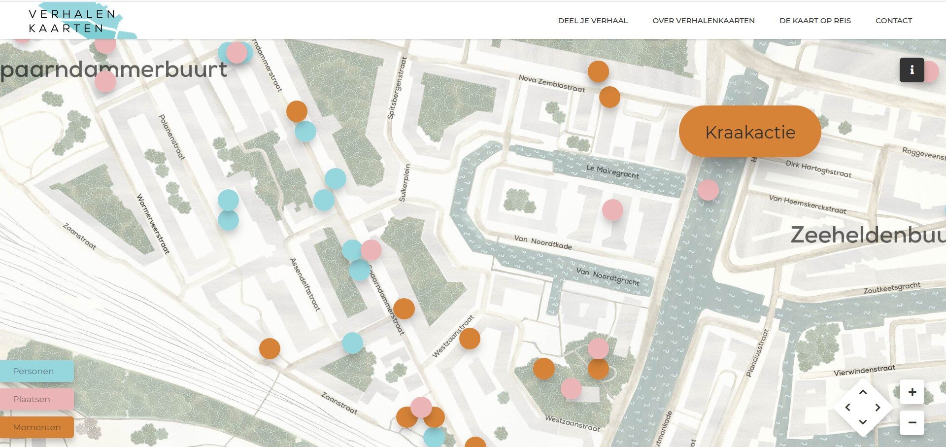
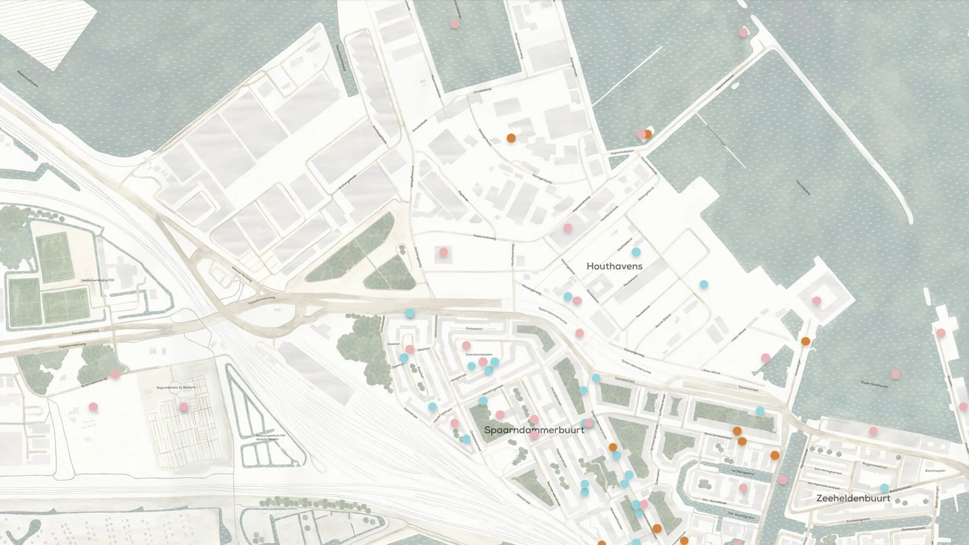
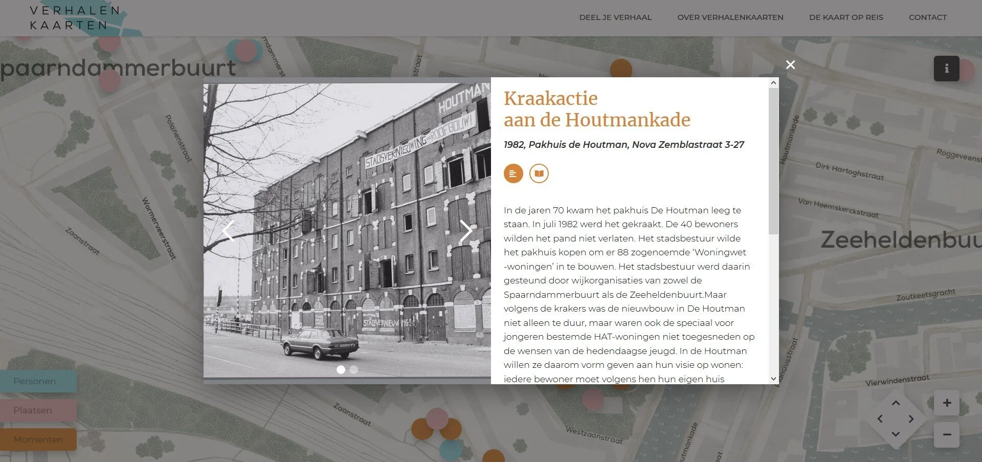
Digital story map
To structure all the collected stories, we followed our analytical Sense of Belonging model. This model focuses on the interaction between Person, Place, and Events. Each story is marked on the map with a dot in the corresponding color: Persons (blue), Places (pink), and Events (orange). Behind each dot you can find text, photo’s and/or sound. Site visitors can submit their own unique stories. Above you see three screenshots of the website showing the result of clicking on the Event 'Kraakactie'.
Story cardsAnalogue Story Map
To make our content more accessible to the neighborhood, we created an analogue version of the story map. This mobile map traveled to various locations, such as the library and a community center. Visitors could read unexpected stories about their district on printed story cards, each corresponding to colours and numbers on the map. The traveling map also collected stories: people could fill out a form and place a corresponding number in yellow on the map.
Storytelling products
Below you will find a collection of concepts for storytelling products about the Houthaven, Spaarndammer- and Zeehelden districts.
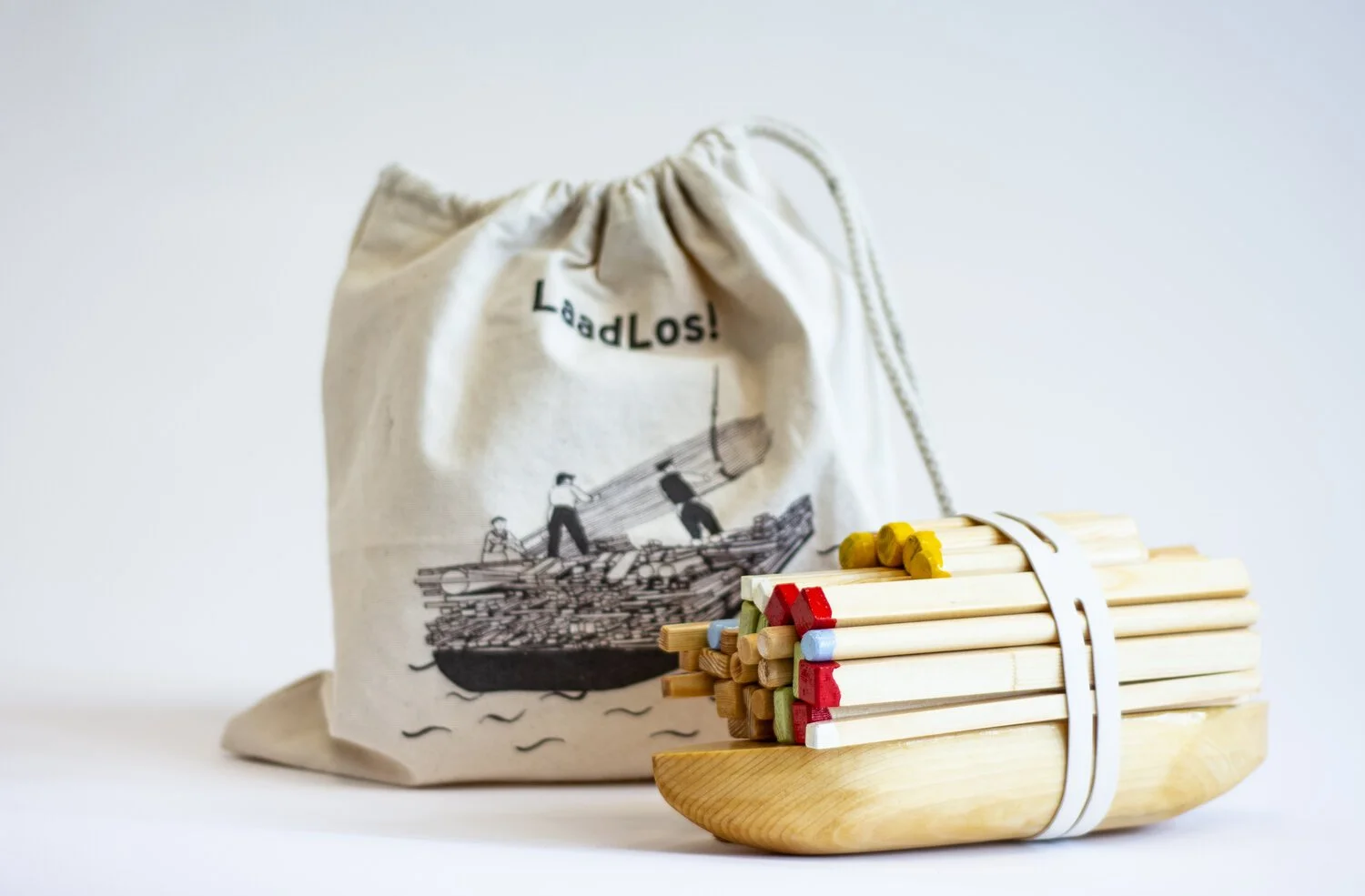
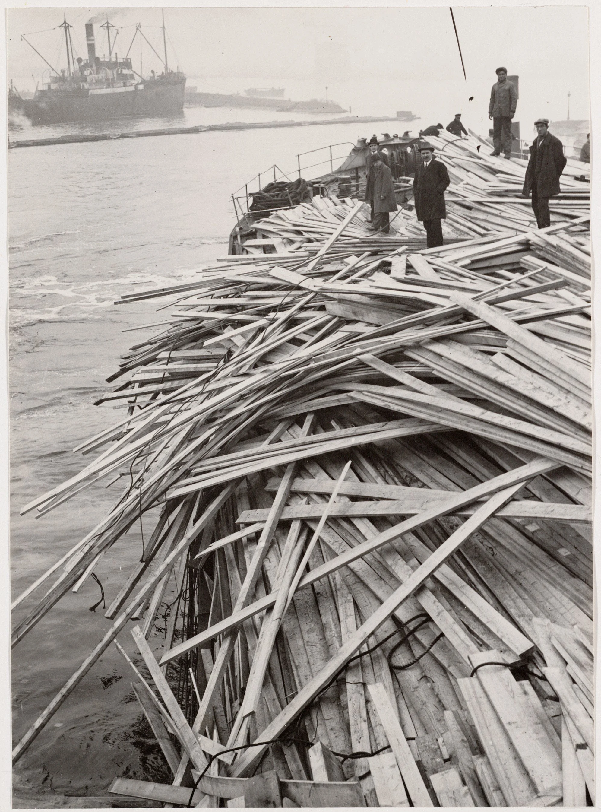
A balancing game inspired by the loading and unloading of boats in former times in the Houthavens. Concept & design by Lieke Frielink
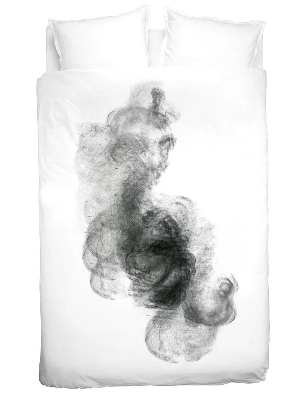
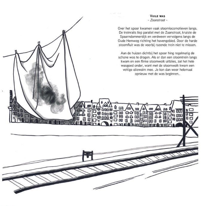
A duvet that tells the story of the houses near the train tracks, where the white laundry hung in the garden. When the steam trains passed by, everything turned black, and the washing had to be done all over again. Concept & design by Lieke Frielink
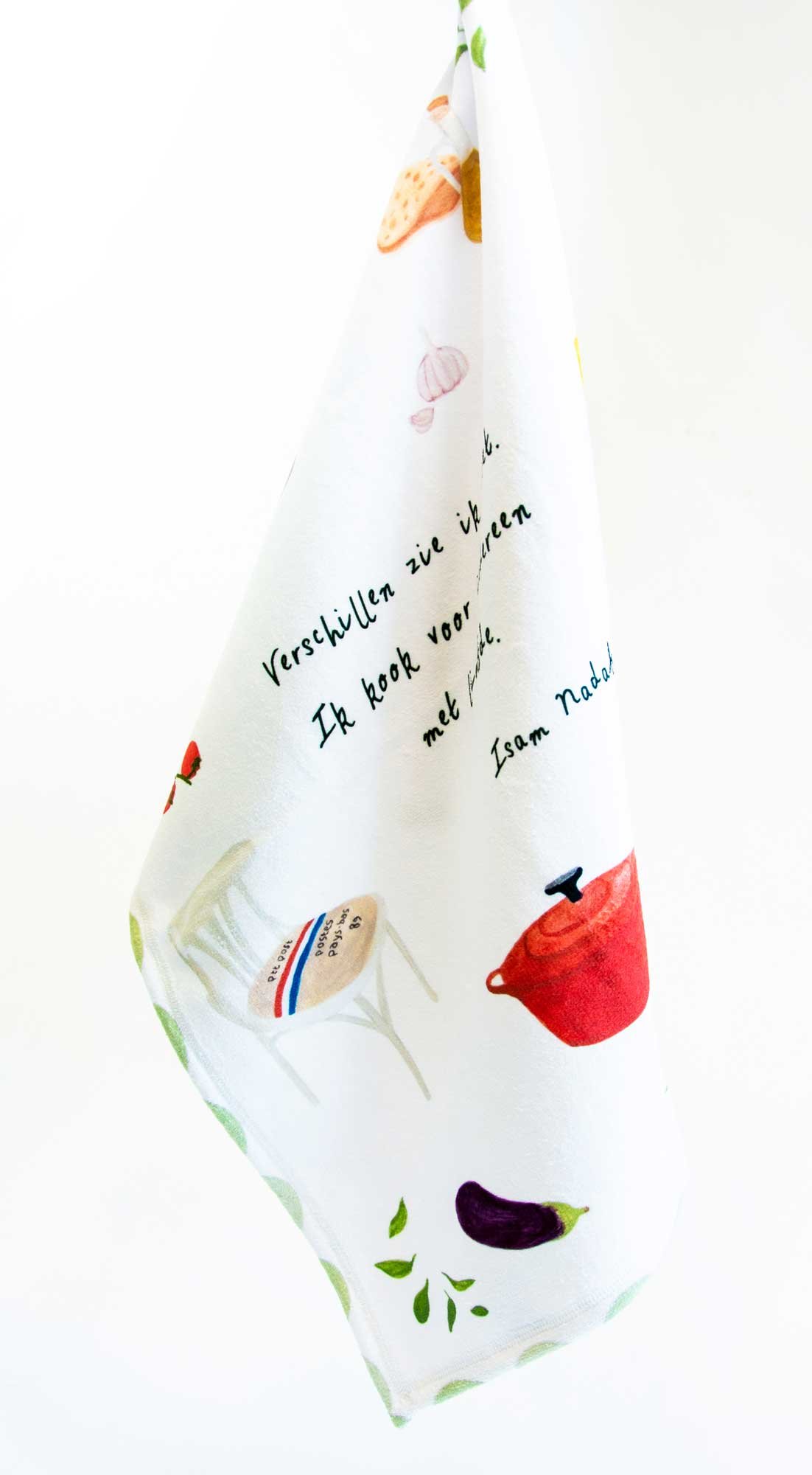
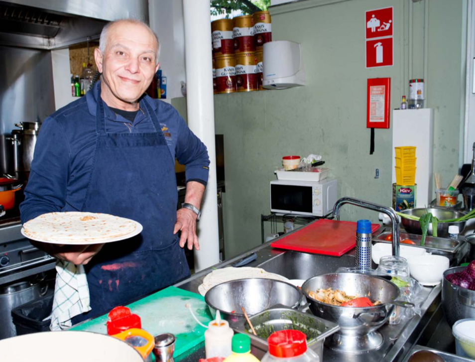
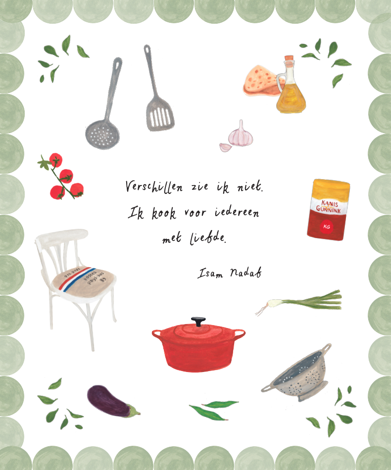
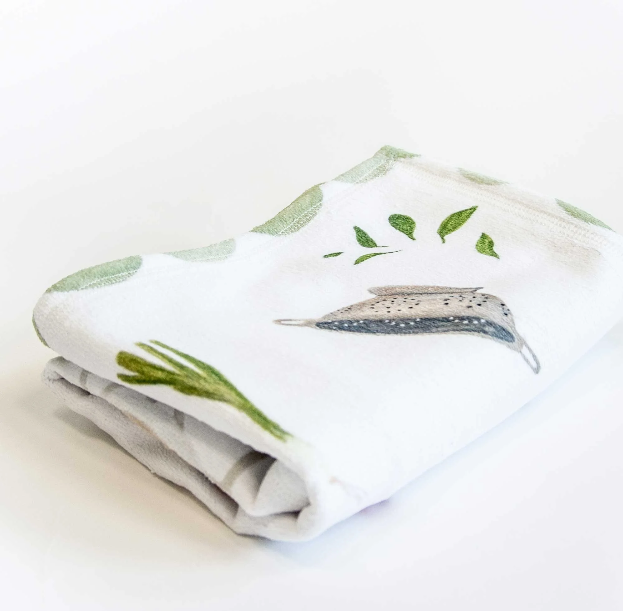
An illustrated tea towel that shows elements of Isam Nadaf’s kitchen, the cook of the local community center. Concept by Lieke Frielink, illustration by Sonja de Boer.
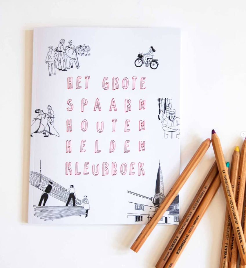
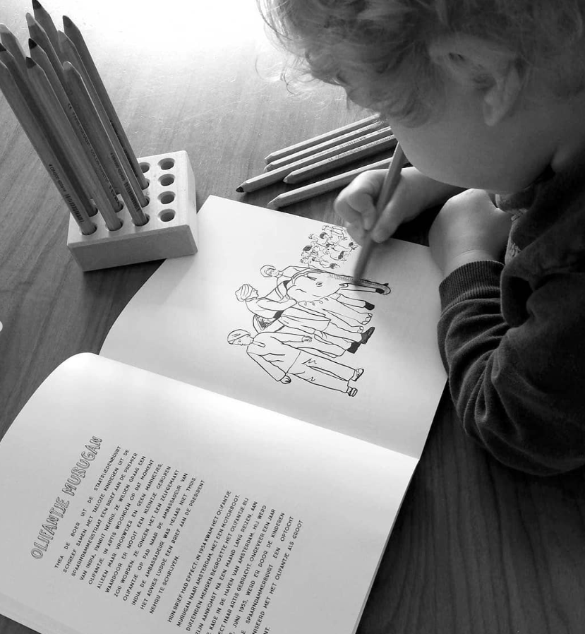
A colouring book about neighbourhood stories. Concept & illustration by Sonja de Boer
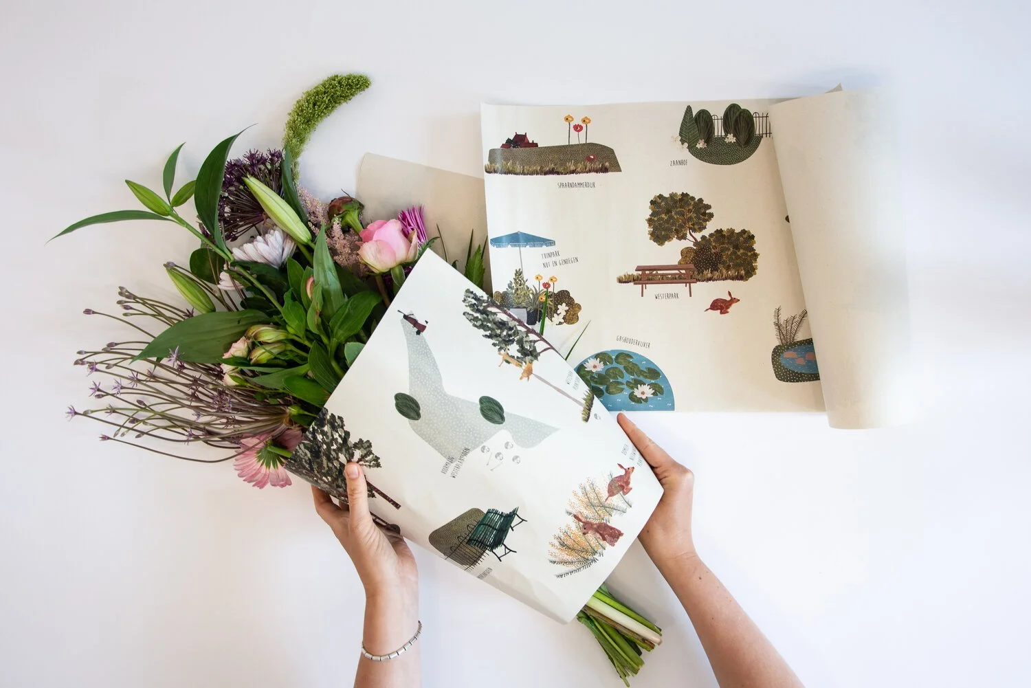
Illustrated wrapping paper for local florists that shows al the green areas of the neighbourhood. Concept by Lieke Frielink, illustration by Sonja de Boer.